
The day after the Oban Sea Kayak Race, I headed north to Arisaig. Rob and his family were off to Gigha for the week, but as I was short of time and the weather forecast for the next couple of days looked excellent, I decided to drive to Arisaig and paddle out to Eigg, for an overnight stop before heading home.
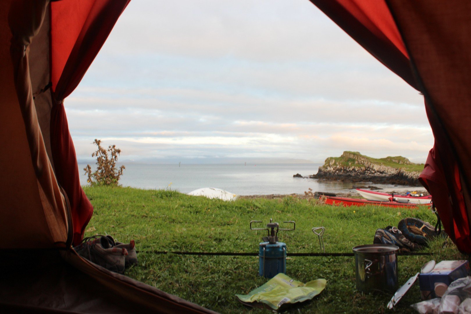
After a very early start packing up the dawn dew wet tent at the Kilbowie Outdoor Centre in Oban and an incredibly beautiful drive up to Arisaig. I found myself parked next to the sea, with Eigg, beckoning me in the background.

I had to be quick sorting out the car, camping gear and kayak, as the tide had turned and if I didn't get a move on I'd have a bit of a rocky shuttle to the sea! Having organised and packed everything in the boat, I thought I'd best check with the lady in the cottage that it would be OK to leave my car where it was. She suggested moving it just around the corner, so as not to spoil their view. Fair enough, so with my car re-parked, I was ready for the off.
 It's about a nine mile crossing to Eigg and the tides run north and south off Arisaig, so no tidal assistance. It was flat calm. I was hoping I would encounter some whales on the crossing. But I didn't see any, just some really big dustbin lid sized jelly fish. There were plenty of other boats out there. It was a most beautiful day.
 The hills of Rúm looked ever so enticing.
I had the Admiralty Chart for the area with me on this crossing. Up until now I had used OS maps for navigating around the coast, but I always found it difficult to accurately plot my position on these maps. I could triangulate for a rough estimate, but I never really feel happy with this solution. OK for good weather coastal paddling, but not really for open crossings. Plotting exactly where I was on the map was a doddle especially using the GPS co-ordinates.
 About 3 miles from Eigg
 The view on my arrival, the clear waters around Eigg and the summit of An Sgurr. The crossing had taken me 2 hours and 15 minutes.
Just after I rounded this rock to get to the campsite, I bumped into a group of sea paddlers from Ribble Canoe Club. They had just arrived. It was funny as we had not seen each other on the crossing. They had also not seen any whales.


Having pitched my tent and sorted my kit I went for a walk. Eigg is truly a stunning place! At the cafe shop in Galmisdale, I was going to have a tea, but then noticed they had real ale! So as I was in need of re-hydration I had a pint and sat outside watching the world go by. Bliss!
Not long after I'd sat down, the sea paddlers from Ribble Canoe club came and joined me. They had decided to climb up An Sgurr and asked if I'd like to come with them. Unfortunately, I'd left my walking boots and socks behind in the car and I only had a pair of trainers on (no socks), but I decided to go with them. If the terrain became too difficult I'd turn around and come back down.


An Sgurr (The Notch) looks like a pinnacle of rock, but is in fact the end of a long ridge. It is the largest exposed piece of pitchstone in the UK. The climb up did involve picking our way through a few boggy areas. My trainers became soaked, but I carried on as every step brought new views.


 Having made it to the top, it was soon time to return to the tent for tea. By the time we made it back to the tents, my trainers were basically dead! My feet were not exactly in great condition either, with multiple blisters and skinned toes, especially on my left foot! But it was definitely worth it.

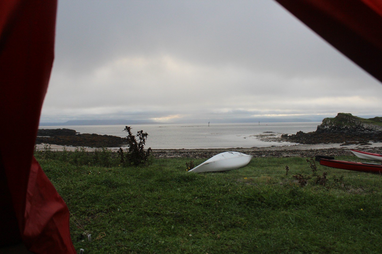
Next morning the weather had changed for the worse. By the time I'd packed up, the mainland was not visible and a slight drizzle had started. It was time to get a move on. I said my goodbyes to the good folk from Ribble CC (I was so envious of them as they were out for the whole week) and headed back to Arisaig. Once away from the shelter of Arisaig I found myself in a good breeze coming from the south, creating a not so nice chop to my right, along with a big Atlantic swell coming from about 30 degrees behind me. I had set a track on my GPS before setting off, which acted as reassurance as the bow of my boat constantly moved around in the waves. I had no sight of land in front of me, but kept, or tried to keep on a 90 degree bearing.
About half way across I suddenly spotted a small dorsal fin 10 meters away, followed very quickly by another. The Minke whales had come to say hello to me! Or were they perhaps wondering what I was doing out there all on my own; something that had occurred to me several times! I thought these first two whales were big, until the third whale appeared very close to me and I realised that this whale was at getting on for nearly twice as long as my kayak! "Err... Ok, that's close enough, thank you" I said! The third big Minke whale had a very distinctive dorsal fin, which was marked with a white dot at the top of the fin. When I returned home and looked on The Hebridean Whale and Dolphin Trust website I am pretty sure this whale was "FM02 Snowy", who has been around the area since 1994. I wished I could stop and take photographs but with the conditions as they were, I didn't dare to start faffing about with my camera. At this point I couldn't see any land in any direction and I really didn't fancy having to practice my roll.
And as quickly as they had appeared, they were gone again. Or I should say, I didn't see them again, but the sea conditions were worsening and I was pretty much concentrating on staying upright and on course. Soon after this brief encounter, I began to see a white dot on land, which I first took for a White house, but on closer inspection of the chart, saw that it was marked as "White Rock". A very big reassuring sign! I had drifted North from my GPS track by a couple of hundred meters, which I had expected with the tide, but at least I could now see land, even it it was a dark grey blob, through the mist.
As I approached land near Luinga Mhór, the chop from the South started to ease off a bit and the Atlantic swell was becoming rather fun. I would slowly rise by a few meters, followed by a sudden rush of speed as I descended into the trough only to be repeated again and again. I was beginning to feel really happy and pleased with myself. I'd seen Whales, a first for me and at close quarters too. And I'd made it back.

I managed to reach the shore just before high tide and so I able to land very close to where I'd parked the car. The return crossing took me 1 hour 57 minutes. The Atlantic swell obviously helping me along. The only thing I had to do now was to load up the kayak onto the roof and drive the 460 miles home!
This trip is simply the best kayak trip I've ever done (so far) and I will definitely be coming back here again. Next time I'll remember to pack some socks and walking boots !
