I'd been thinking about doing the Holy Island trip for some time, but what with Covid, a knee replacement, a bicycle accident - which caused my bad knee to swell to the point I started getting DVT's (Deep Vein Thrombosis) in the calf muscle of my bad knee/leg, followed by a pulmonary embolism (from the clots in my leg going to my lungs), not to mention the inflammatory reaction after my 2nd Covid jab (long Covid), I somehow never got around to it! So basically, I have not done a great deal of paddling in 2021. In fact, very little and most of that was on the local rivers. So what better way to start back with a little trip around the island? After all it's only just over 18nm, should be easy (err.. long covid/lack of paddle fitness etc etc permitting)
So I started my planning, setting off from Borthwen and heading in an anticlockwise direction. After much research, this is what I finally came up with:
| From | To | Depart | Arrive |
|---|---|---|---|
| Borthwen | Cymyran Straits | 11:07:12 | 11:36:20 |
| Cymyran Straits | Four Mile Bridge | 11:36:20 | 12:24:09 |
| Four Mile Bridge | Stanley Embankment | 12:24:09 | 12:44:21 |
| Waiting for Stanley | |||
| Stanley Embankment | Breakwater Lighthouse | 13:12:00 | 1:59:17 |
| Breakwater Lighthouse | North Stack | 13:59:17 | 2:25:53 |
| North Stack | South Stack | 14:25:53 | 2:42:46 |
| South Stack | Penrhyn Mawr | 14:42:36 | 3:07:27 |
| Penrhyn Mawr | Rhoscolyn Head | 15:07:27 | 4:49:10 |
| Rhoscolyn Head | Borthwen | 16:49:10 | 5:11:31 |
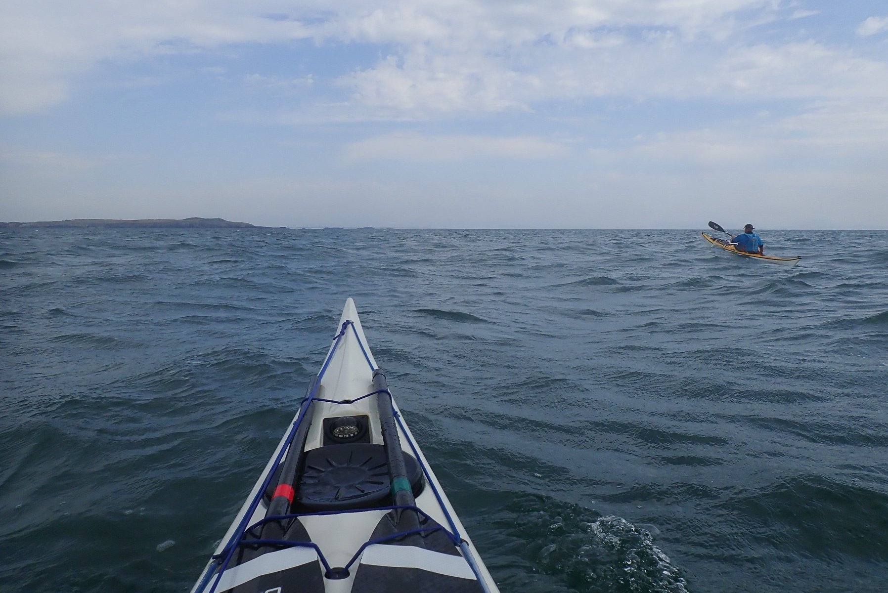
Kris was also keen to have ago at this somewhat exploratory attempt, as he also had never done this trip. So arrangements were made and suddenly we were on the water at Borthwen, all ready to go.
1 Borthwen to Cymyran Straits
Having picked a bouy near the entrance to Borthwen, which we would use as our finishing point on our return, we set off. Albeit at 11:07:12, eight minutes (7 min 48 Secs) before scheduled. Something was very apparent straight from the off, we were paddling straight into a strongish breeze, as well as the swell. I said to Kris, we are going to have it very tough on the return leg from PM to Rhoscolyn, if this wind keeps up...
I really hate paddling into the wind, it saps all my strength and I end up losing a lot of time! But the sun was shining the sea was blue, we were feeling good, so we carry on.
On my plan, I'd estimate that if we left at 11:15 we should arrive at the entrance to Cymyran Straits at around 11:44. We actually arrived at 11:36, ever so slightly ahead of schedule (now 8 mins and 2 secs), a whole 16 seconds up, whoo!. Considering we were battling into the wind and swell, I think in optimum conditions, we would be much quicker over this section.
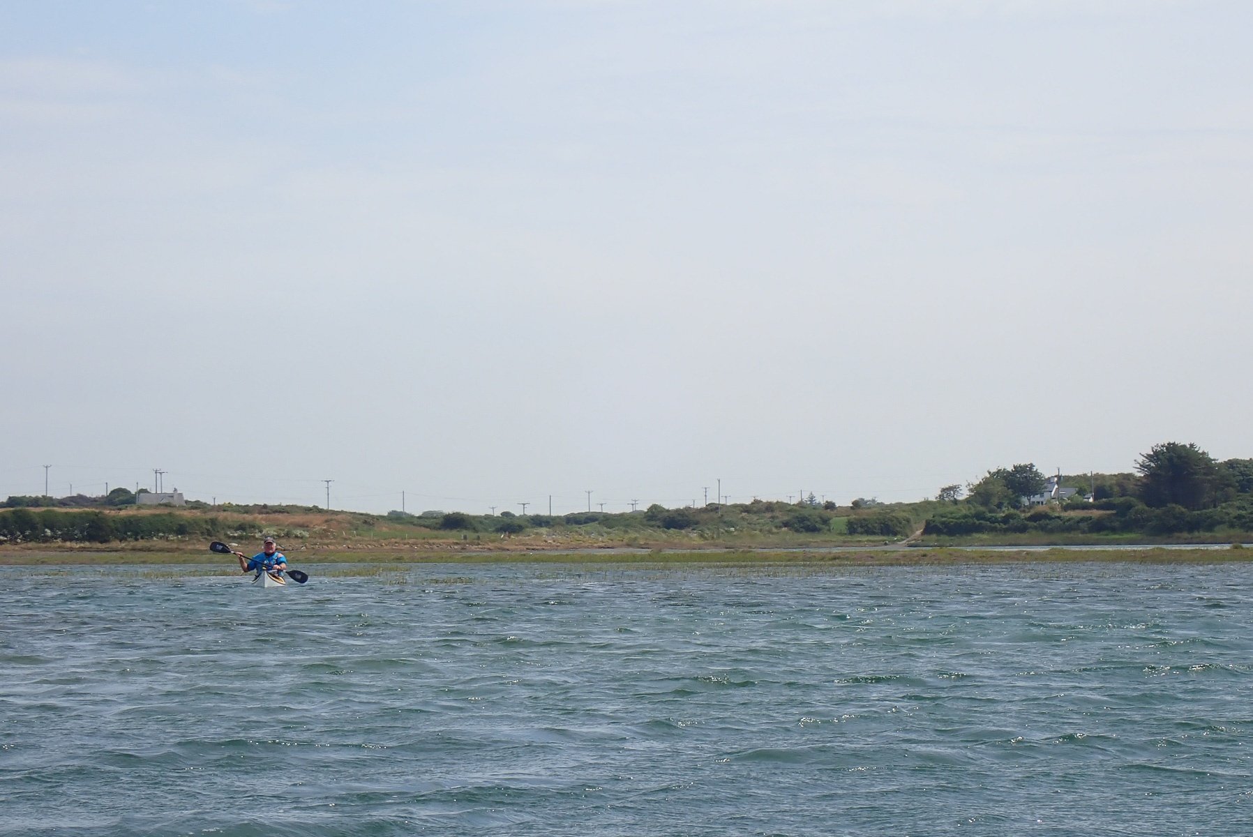
2 Cymyran Straits to Four Mile Bridge
I have never paddled up the Cymyran Straits at this state of the tide. I was expecting there to at least be a defined channel, which we would have to eddy hop our way up. But instead the level was much higher, with the area completely flooded. Not only was it difficult to find the best route, but it was also difficult to see where the route actually was! It was a completely different landscape to what I could remember from previous trips up Cymyran; It was a very shallow lake in places, and definitely not a river! When I think about it now it makes sense. After all we were aiming for HW at Four Mile/Stanley. It's bound to be flooded, err lake like! Duh!
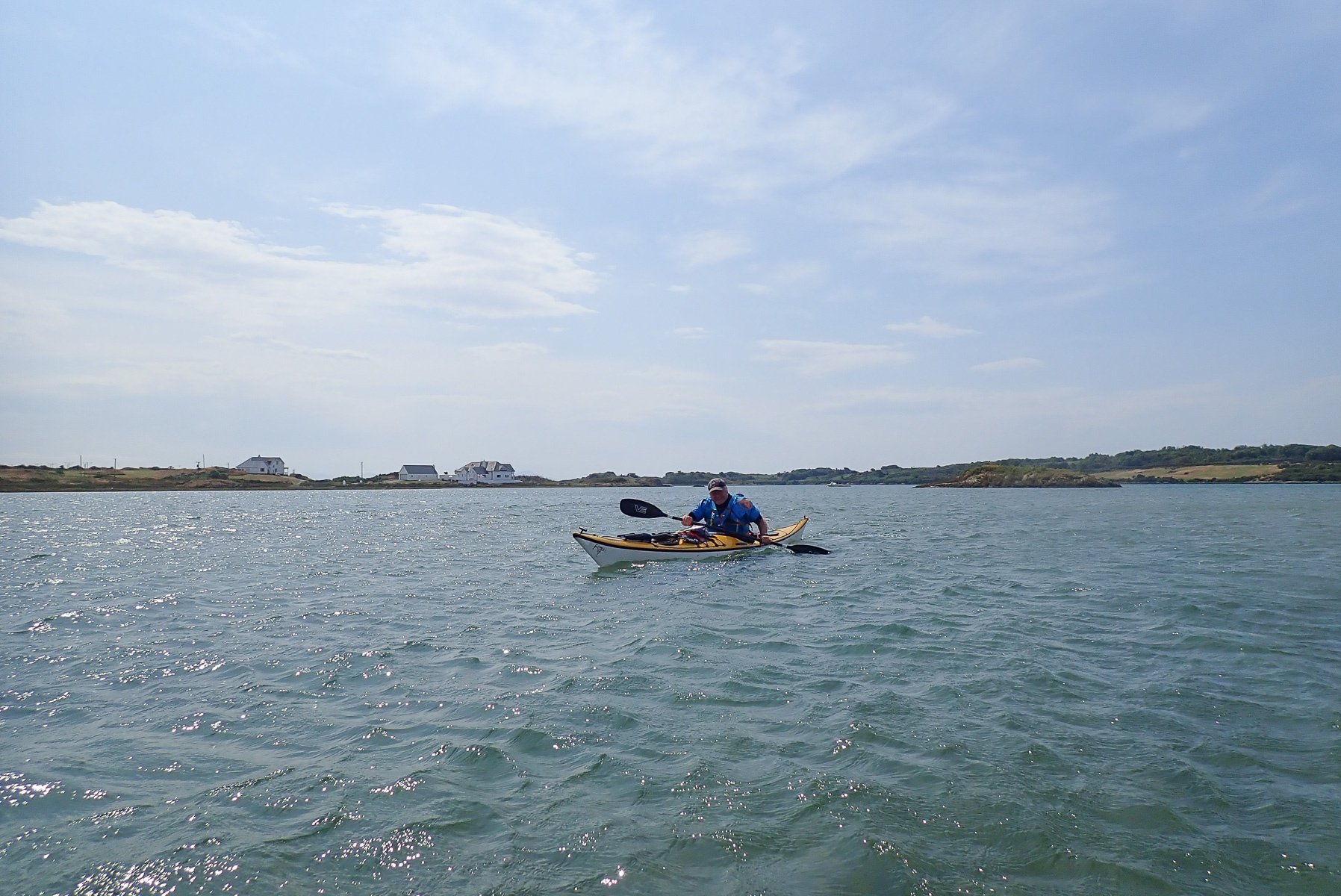
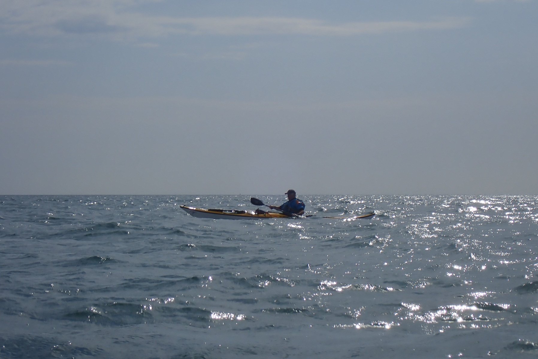
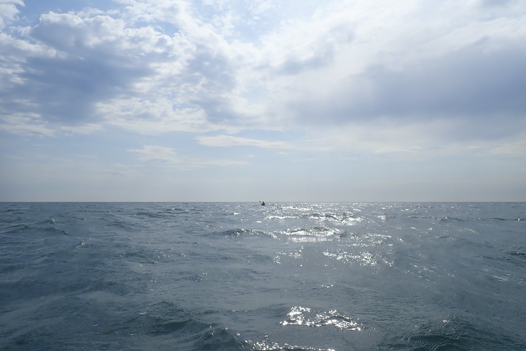
Again at times the wind hampered us and a pattern was certainly emerging - Kris was quite a lot quicker than me, with him having to often stop and let me catch up. Hence, most of the photos on this blog post are by Kris (thanks Kris). He had many a photo opportunity.
At one point, we paddled into an ever decreasing depth of water, a sandbank, and our progress slowed quite significantly, that is until we managed to find deeper water. But eventually we could see Four Mile Bridge in the distance, as we worked our way, searching for deeper water, around the many sandbanks.
We arrived at Four Mile Bridge at 12:24:09. I'd planned for 12:30:17, so yes we had lost a bit of time (unsurprisingly) on this leg. Not that it would matter as we were going to have to wait at Stanley, for the tide to change.
Four Mile Bridge was flowing nicely into the Inland Sea, a small drop with a little stopper at the entrance. Both Kris and I shot through here, probably startling the fisherman stood above us on the inland sea side.
If we ever do this again and hope to make a good time around Holy Island, then this section will need some serious planning and inspection, to prevent the faffing, of finding the best route, on the fly.


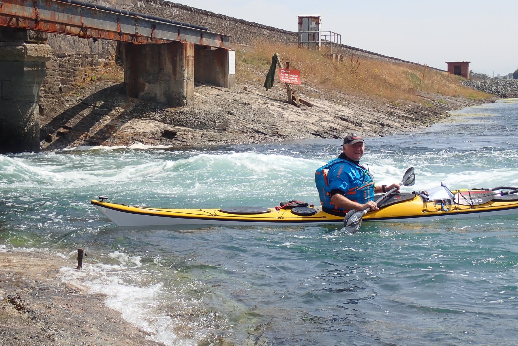
3 Four Mile Bridge to Stanley Embankment
Leaving Four Mile Bridge behind us, we paddled across the inland sea, back into the wind once again. I was having to use a fair amount of skeg, as the wind was slight off to my right and my boat kept wanting to track into the wind. There was a man stood in the water up to hips, about a quarter of a mile off shore - presumably coaching one or two of the wind surfers. He did look odd stuck out there and reminded me of the Antony Gormley figures in the sea, off Crosby, near Liverpool.
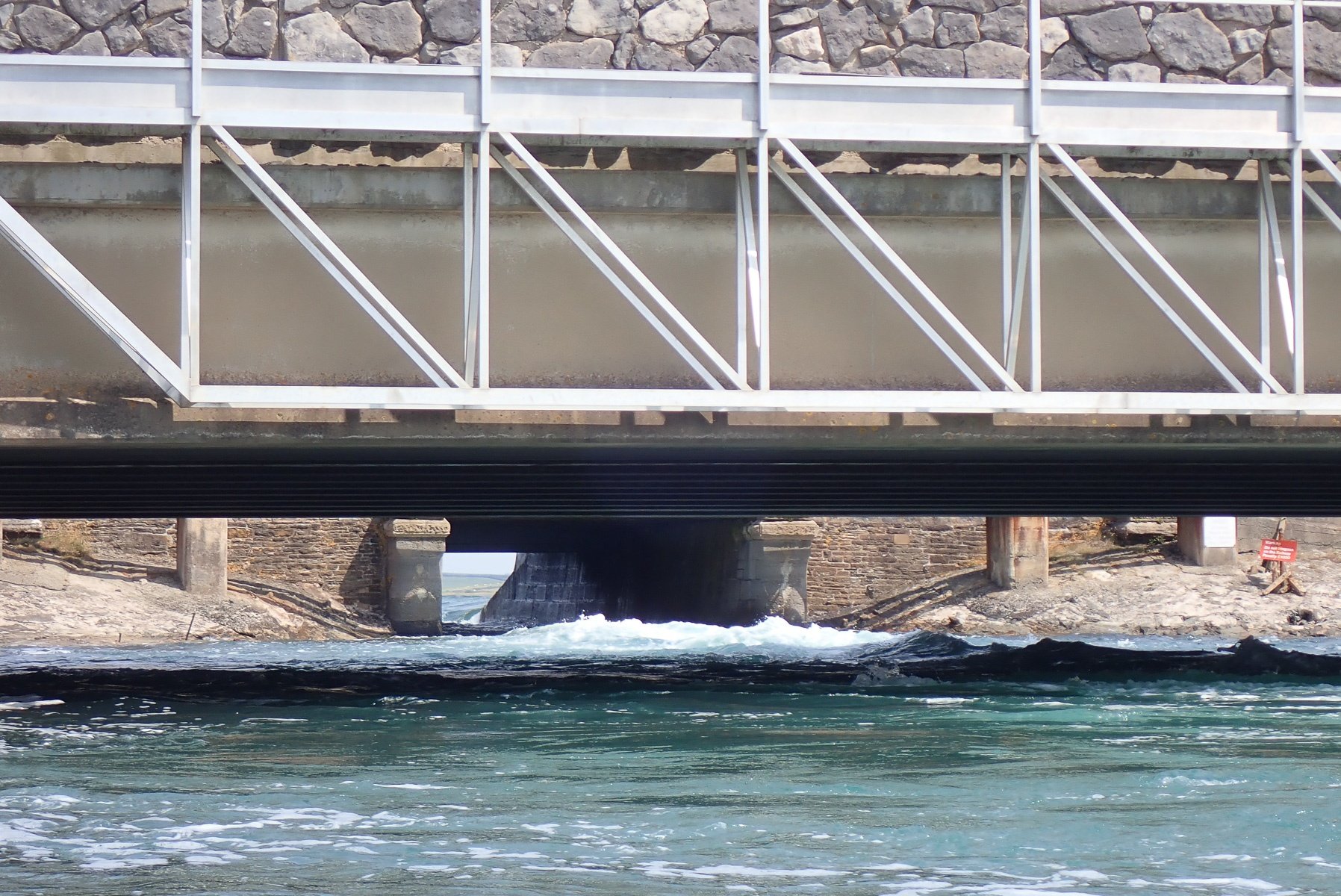
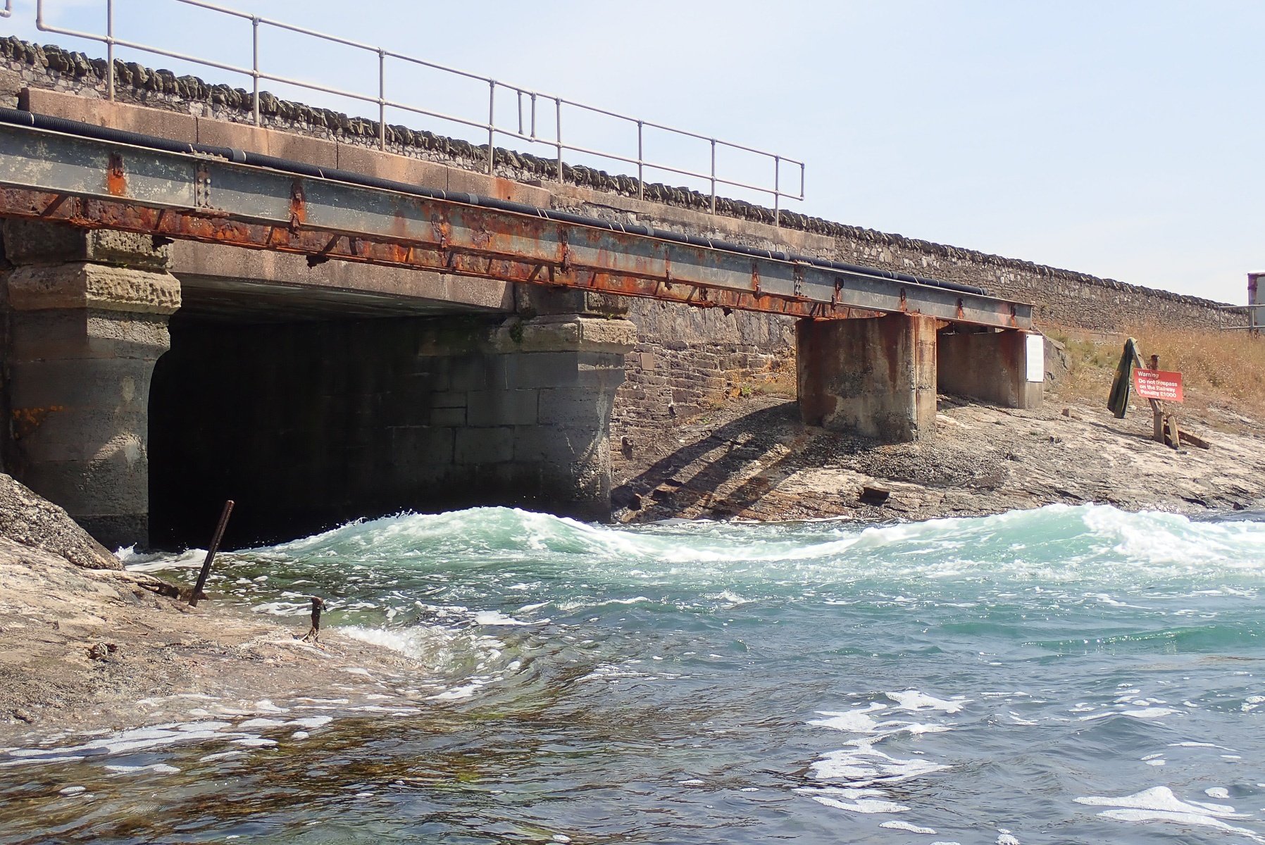
Having not paddled through the inland sea before, I found it quite pleasant, despite the wind. We arrived at Stanley at 12:44:21. According to the guide book Stanley starts to flow north, out of the inland sea, one hour after HW liverpool. HW Liverpool today was at 12:09. So we were going to have to wait a while. Looking at the wave train Stanley was producing when we arrived, we had absolutely no chance of getting through the tunnel. The height difference was rather large and the play wave quite big.
I had always wondered what the Stanley wave was like, having only ever seen a few pictures of it. You can't see it from the old A5, and I've only had a fleeting glimpse traveling down the new road, the A55. I knew that the Stanley wave formed between the road and rail bridges, but could never work out what was actually under the A55 road bridge, a big arch or small arch? Now I know the A55 road bridge is actually a large arched bridge, meaning if you come off the wave, you will get washed into the inland sea, where there is plenty of space below the wave to pick up the pieces, regain the back eddys and do it all over again. Having seen the wave, I am not sure if I would take bother taking my playboat along, Hurley weir is much nearer to home for me.
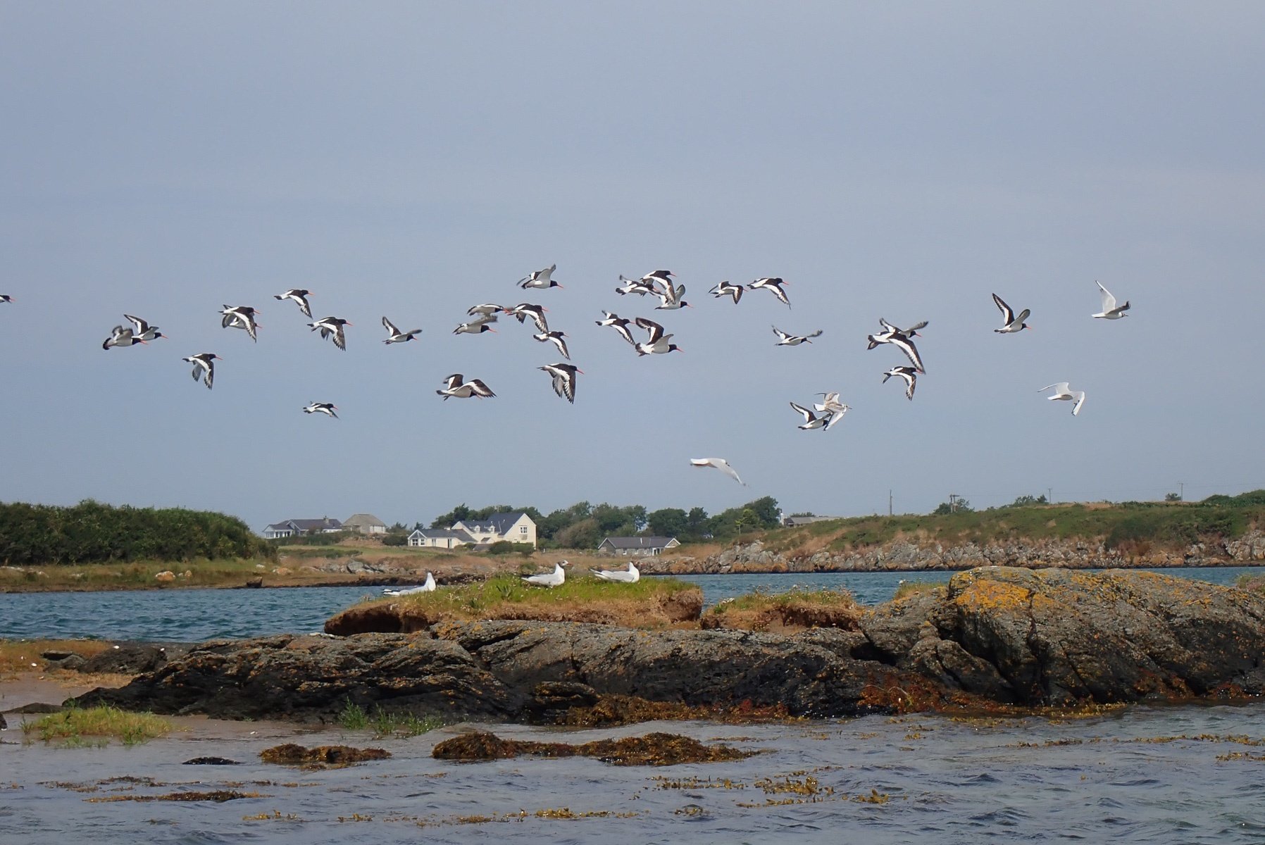
Whilst waiting for the tide, it was a good time to refuel. Take some piccies and admire the numerous crabs legs on the banks.
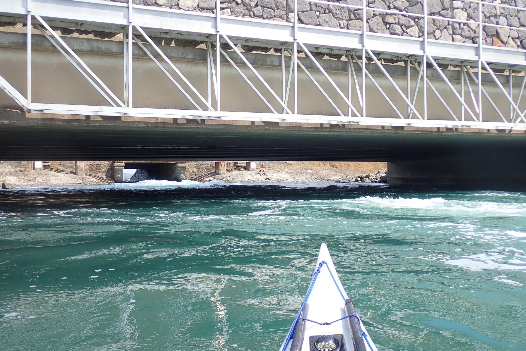
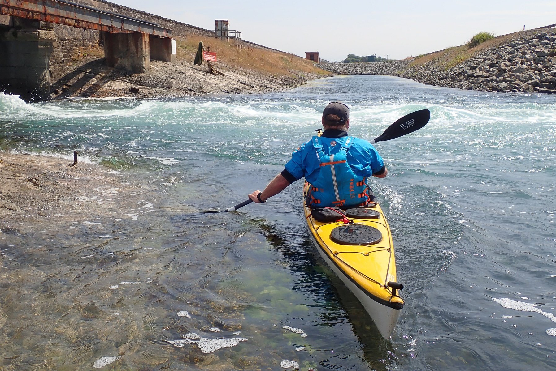
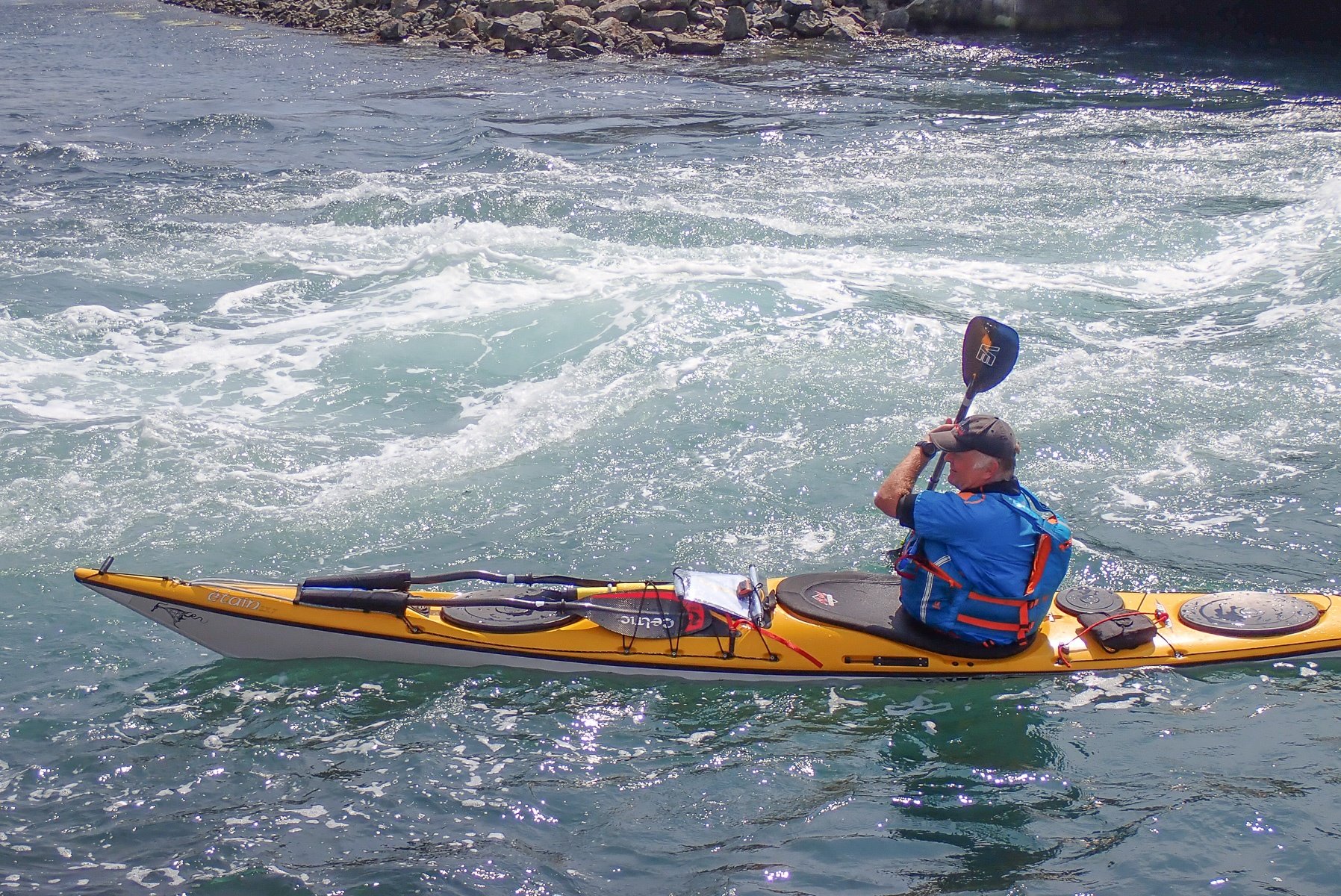
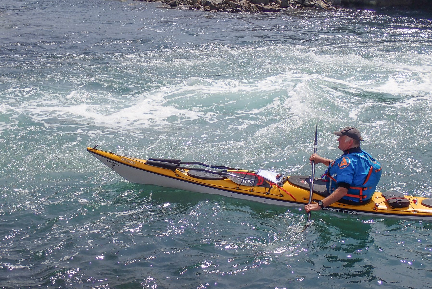
Eventually the rate of flow through the tunnel began to slow (it did this quite suddenly) and we got back into our boats ready to go through the tunnel. I had one go and couldn't quite manage to get through, the flow was still strong flowing into the inland sea. Then on my next attempt, paddling hard, I made it through. The time now was 13:12 and yet the flow was still going into the inland sea. I can only think the strong wind on the north side was affecting the tide pushing it bit later than advertised.
I'd read about the dangerous stopper than can form inside the tunnel at certain states of the tide. This was not at all in evidence, but I did notice, what looks like a tidal gate, half way through the tunnel, which looks like it can be lowered into the tunnel effectively blocking off the sea from the inland sea. I guess it is the iron work receiving this gate, under the water, which possibly forms the stopper.
Kris soon followed me through and we were now on the next leg.


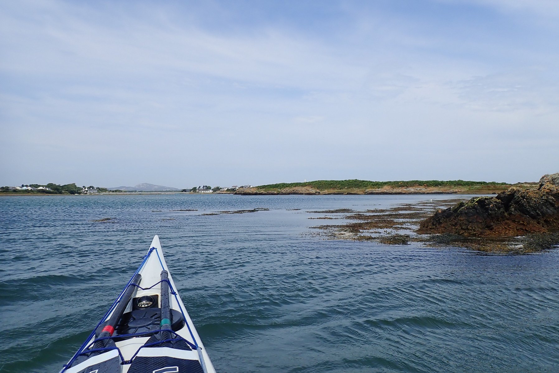
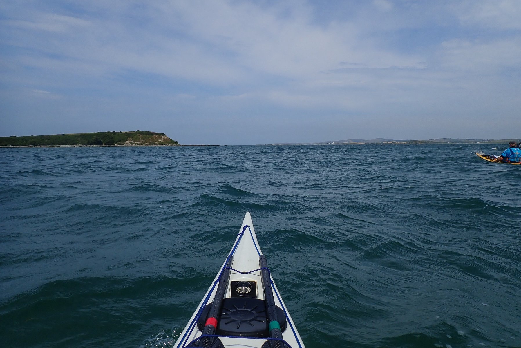
4 Stanley Embankment to Holyhead Breakwater Lighthouse
Having left Stanley behind us, we paddled into a fairly choppy sea and into what seemed like an ever-present headwind. The plan here was to paddle north until passed Penmon, then head across Holyhead harbour to the Breakwater light. It was around about this point I started having an equipment malfunction! My new (worn only a few times before) PeakUK Shortie cag started giving me trouble. Basically the shorty arms have dry rubber arm seals inside to stop water from getting into the cag. To be honest I really like these seals as when I've rolled wearing the cag, I stay nice and dry. The cag itself is really well made with loads of nice design features. But now, with the constant pressure on my biceps, particularly my right bicep, I was starting to get cramp in my arm. In fact, my right arm was beginning to go numb! Rearranging the rubber seal, gave me some temporary relief, but I found the only way to combat this issue was to try to pull the rubber seal down over my elbow. Not good as inevitably it would rise back up again. I need to trim the seals, but at this moment it was not the best of times!
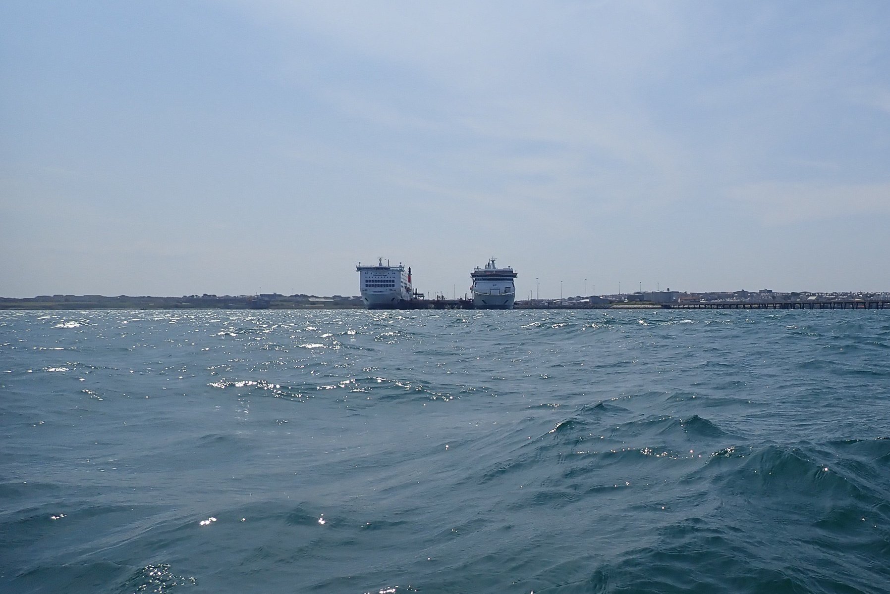
I can now see from our GPS track, we were 1.7 nm from the Breakwater Lighthouse when we called up Holyhead port control (VHF 14). It always best to ask if there were any shipping movements to avoid being run over! We were told the ferry would be leaving at 14:00. It was now 13:33, so time to get our skates on.
Having changed direction to aim for the Breakwater Lighthouse, the wind and swell was now hitting us more or less side on. Looking at my GPS log, we averaged 4 kt over this section. Perhaps the thought of being run over by an Irish Sea Ferry spurred us on.
As we approached the lighthouse on the end of the Breakwater, the sea was quite big and bouncy. I quite enjoyed rounding the lighthouse. Not only had we made it across the harbour in time the Tide, Wind and Swell were all now behind us. It was now 13:59:17. Exactly the same as I had planned.

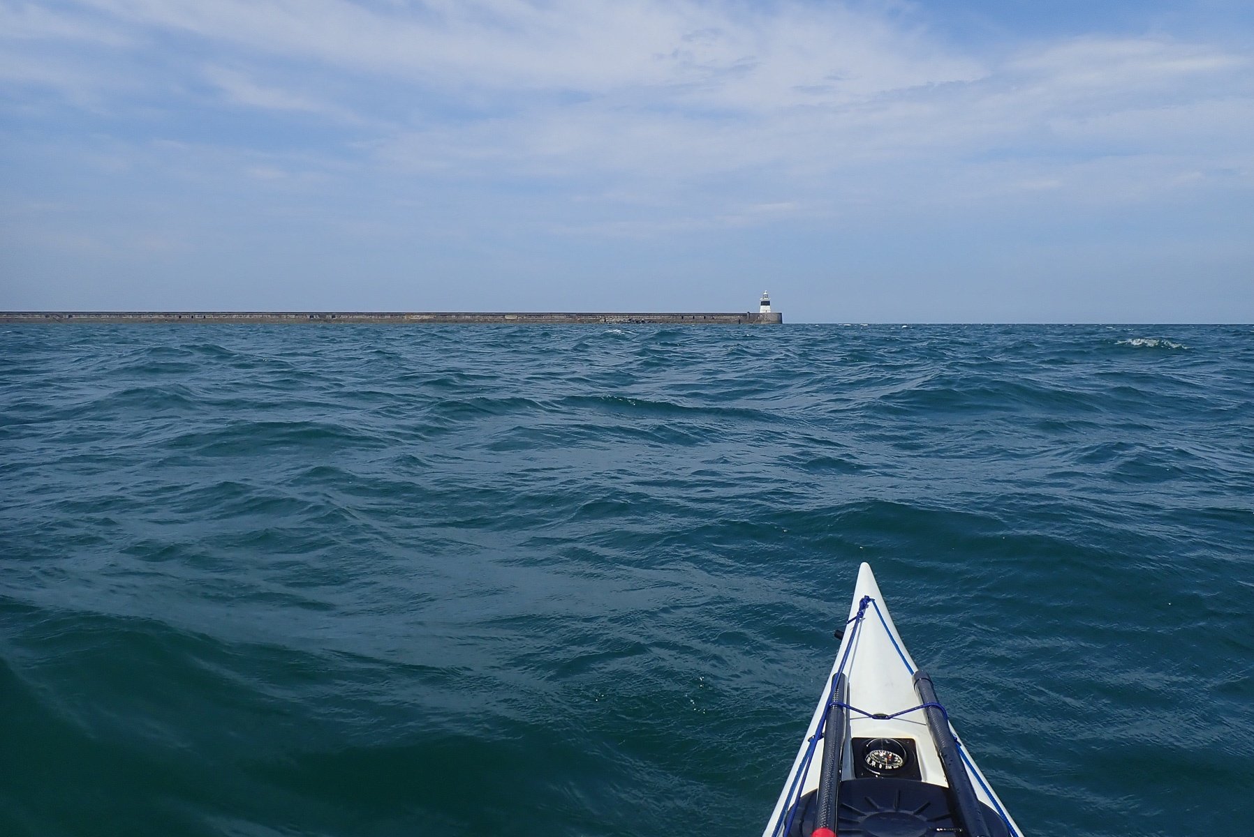

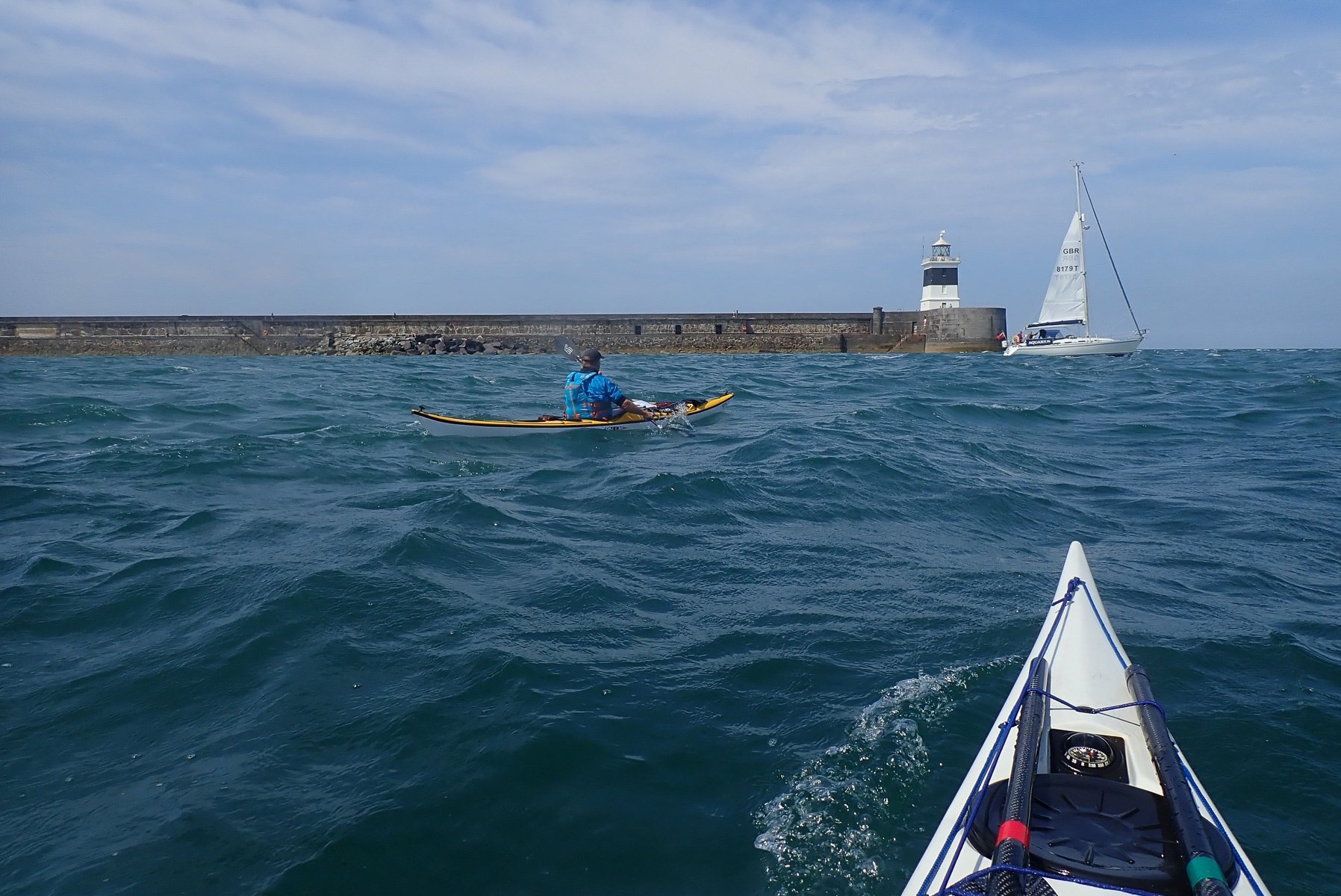
5 Holyhead Breakwater Lighthouse to North Stack
We were now being shot towards North Stack at a good rate. My GPS shows how our speed increased over this section, 6 kts for a fair way, followed by a section at 7 kts, culminating in 8 kts as we passed by North Stack. It was so nice not to have the wind in our faces for a change. It was still fairly bouncy though, with the swell pushing us from behind.
Quote of the day came from Kris: "North Stack doesn't look very big" ... errr I think we both begged to differ after we had paddled through it! Yeah you can see them peaks, but not them troughs!
I am still struggling with my arms going numb, but there really isn't much I can do about it. Keep calm and carry on paddling... yeah!
The plan had us arriving at 14:40. It was now 14:25:53. We were up by just over 14 minutes!


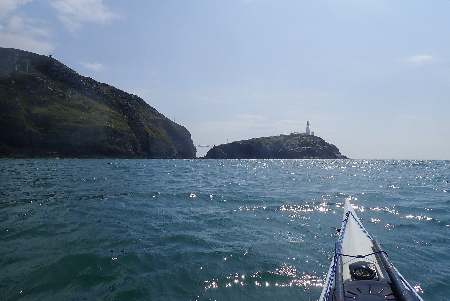
6 North Stack to South Stack
Now on to South Stack... Another quick downwind section with once again, our speed increasing as we approached and passed South Stack. It was as we started to go around South Stack I noticed that the tidal stream was very much heading in a SW direction, rather than heading South. Even so we turned to the South and we were still getting some assistance from the tide.
I had planned to pass South Stack at 14:52. The time now was 14:42. OK so we lost a bit of time - 5 minutes. Possibly as I was still having problems with my cag/arms, but I was also getting tired. Also, this is where my planning started to unravel itself...
7 South Stack to Penrhyn Mawr
This is where my planning started to go all wrong! I was not expecting the tidal stream off South Stack to head in a SW direction. I was expecting it to go more Southerly, as I had experienced before (on a different state of the tide). So I had made a big mistake. However my plan was to arrive at Penrhyn Mawr at 15:07 and we arrived at 15:07! My planning was obviously spot on - err not to mention the 15 minutes we had gained earlier.
As we approached Penrhyn Mawr we realised we were paddling into a very large back eddy! Whoops! Big mistake.
At least we can just about see the finish - Rhoscolyn Beacon, in the distance.

8 Penrhyn Mawr to Rhoscolyn Head
Just after Penrhyn Mawr, things started to get really bad. We are now heading back into the wind and swell again, but also, we are now paddling against a very large tidal eddy. Our progress slowed to a crawl (if that!).
The coast to our left moved ever so slooooowly. We tried had not to look at out GPS speeds, it was far far too depressing. We were probably paddling at 4kts, but only making less than 2kts over the ground! Paddling further out to avoid the eddy and hopefully catch faster water, didn't really help as, it meant that at some point you would have to paddle directly back into the headwind and swell, full on.
The only thing for it was just to keep paddling, not to look at the coast and and not to look at the GPS speed. I remember not doing this and seeing Porth Dafarch in the distance, then 15 minutes later looking again and still seeing Porth Dafarch. Oh soooo slow. Rhoscolyn Beacon seemed so far away and wasn't getting any closer. Arrrrgghhhh! The time slowly ticked by.
My (slightly off/incorrect) planning was to arrive at Rhoscolyn Head at 15:41, We were over an hour late at 16:49.


9 Rhoscolyn Head to Borthwen
Eventually, we reached Rhoscolyn Head, and tucking into the cliffs to avoid the wind, we slowly made our way back to Borthwen. The time now was 17:11. The planned arrival time was for 15:52! So only a tad out!!!
So that was it, we did it in a time of 6 Hours, 3 minute and 51 seconds.
I was completely and utterly knackered. The first thing to do was to get that dry shortie cag off - my biceps were very bruised. What a relief that was!

As for "It's all about Staney", it isn't! It's more about getting the planing right all the way around! I am not at all sure how I managed to mess up the crucial last 5 nm. Maybe it was due to it being a long leg at the bottom of my workings out. Either way I missed doing the calculations. Picking better weather conditions would help a great deal too! Yes the pictures all look lovely, but that wind for me was a real killer for me.
And then, there were my cag issues with the seals compressing my bicep muscles and painfully cramping my arms. A few days on from this paddle and I still have very bruised biceps/arms. I've now cut some of the rubber off the cuffs to enlarge the hole, but even trying the Cag on for a few minutes with larger cuffs, irritated my arm/muscles. The cag is now hanging up, with some rather large duct tape spools inserted into the cuffs, to hopefully stretch the rubber cuffs out further.
Having said all that, paddling around Holy Island was was a bit of an exploratory mission and there was a lot learnt from this trip.
Would I do it again, oh yes. And hopefully a bit quicker next time!
Many thanks go to Kris for putting up with Mr slow coach here and for the many excellent pictures.

3 August 2021
Excellent write-up, Simon, thanks! And an equally excellent trip.